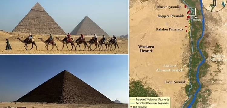
Archaeologists have discovered that the famous structures could have been built along a long-lost branch of the river Nile. Researchers from the University of North Carolina Wilmington studied satellite imagery to find the possible location of a former river branch running along the foothills of the Western Desert Plateau, very near to the pyramids.

Lost branch of Nile may help solve mystery of construction of Egyptian pyramids
Pyramids, including Giza pyramid complex, may have been built along lost branch of Nile, according to study
Scientists think they are closer to solving the mystery of the construction of ancient Egypt’s pyramids, including the Giza pyramid complex that was constructed more than 4,000 years ago.
A study published Thursday in the Communications Earth & Environment journal suggests that a long-lost, ancient branch of the Nile could have built the pyramids.
Researchers from the University of North Carolina Wilmington used radar satellite imagery, geophysical data and deep soil coring to map the hidden river branch.
The team named the branch "Ahramat," which means pyramids in Arabic, and said it was about 64 kilometers (39 miles) long and between 200 meters - 700 meters (656 feet -2,296 feet) wide.
“Many of the pyramids, dating to the Old and Middle Kingdoms, have causeways that lead to the branch and terminate with Valley Temples which may have acted as river harbors along it in the past," the researchers said in their paper.
“We suggest that the Ahramat Branch played a role in the monuments’ construction and that it was simultaneously active and used as a transportation waterway for workmen and building materials to the pyramids’ sites,” they said.
Writing in the journal Communications Earth & Environment they said: 'The largest pyramid field in Egypt is clustered along a narrow desert strip, yet no convincing explanation as to why these pyramids are concentrated in this specific locality has been given so far.
'Here we use radar satellite imagery, in conjunction with geophysical data and deep soil coring, to investigate the subsurface structure and sedimentology in the Nile Valley next to these pyramids.
'We identify segments of a major extinct Nile branch, which we name The Ahramat Branch, running at the foothills of the Western Desert Plateau, where the majority of the pyramids lie.
'Many of the pyramids, dating to the Old and Middle Kingdoms, have causeways that lead to the branch and terminate with Valley Temples which may have acted as river harbours along it in the past.
'We suggest that The Ahramat Branch played a role in the monuments' construction and that it was simultaneously active and used as a transportation waterway for workmen and building materials to the pyramids' sites.'




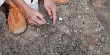 Yüzey Araştırması ve Türk-İslam Dönemi Arkeoloji Kazılarına TTK Desteği Başvuruları başladı
  Bulgaristan geleneksel festivalleriyle ve bayramlarıyla dikkati çekiyor
  Türkiye'deki tescilli mağaralarda 30 memeli türü ve endemik canlılar keşfedildi
 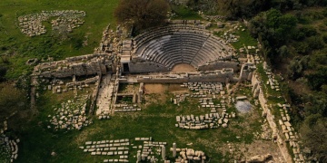 Teos Antik Kenti'ndeki Dionysos Tapınağı'nda kazı ve restorasyon çalışmaları devam ediyor


